Salihli
The city of Salihli, the seat of the district, is located on İzmir-Ankara (E 96) highway and the parallel railway connections. The urban zone is situated on the slopes of Bozdağ mountain chain along the southern alluvial plains of the Gediz River. To the north and northeast of the plain extend two other mountain ranges, respectively those of the mounts Dibek (highest altitude 1120 m) and Üşümüş (highest altitude 1085 m).
The town lies at an altitude of 125 meters from the sea level. Its advantageous location, smooth and busy intercity connections and the fertile soil allowed Salihli to develop extremely well in the recent past.
Four streams, namely Alaşehir, Gümüş, Kurşunlu and Sart cross the district area to join the River Gediz, which flows westward. The climate type is Mediterranean climate. To the 24 km north of the city is Demirköprü Dam, used for irrigation, prevention of overflows, energy production and fishing, and which was built between 1954 and 1960.
The population figures in the 2000 census were 149,150 for the whole district and 83,137 for the urban center of Salihli. (The urban population is 162,782 as of 2019.)
Aside from the city of Salihli, the district counts eight townships with their own municipalities. These are Adala, Durasıllı, Gökeyüp, Mersinli, Poyrazdamları, Sart, Taytan and Yılmaz. Of these, Sart corresponds to the location of ancient Sardes, the capital of Lydia.
The district area is surrounded by the neighboring districts of Ahmetli to the west, Gölmarmara to the northwest, Gördes and Köprübaşı to the north, Demirci to the northeast, Kula to the east, Alaşehir to the southeast and Ödemiş to the south.
The distances from Salihli to the seat of neighboring provinces are as follows:
The distances from Salihli to another cities of Manisa are as follows:
Map - Salihli
Map
Country - Turkey
 |
|
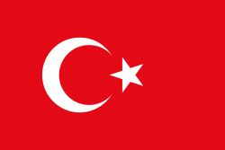
| Flag of Turkey | |
One of the world's earliest permanently settled regions, present-day Turkey was home to important Neolithic sites like Göbekli Tepe, and was inhabited by ancient civilisations including the Hattians, Hittites, Anatolian peoples, Mycenaean Greeks, Persians and others. Following the conquests of Alexander the Great which started the Hellenistic period, most of the ancient regions in modern Turkey were culturally Hellenised, which continued during the Byzantine era. The Seljuk Turks began migrating in the 11th century, and the Sultanate of Rum ruled Anatolia until the Mongol invasion in 1243, when it disintegrated into small Turkish principalities. Beginning in the late 13th century, the Ottomans united the principalities and conquered the Balkans, and the Turkification of Anatolia increased during the Ottoman period. After Mehmed II conquered Constantinople (Istanbul) in 1453, Ottoman expansion continued under Selim I. During the reign of Suleiman the Magnificent, the Ottoman Empire became a global power. From the late 18th century onwards, the empire's power declined with a gradual loss of territories. Mahmud II started a period of modernisation in the early 19th century. The Young Turk Revolution of 1908 restricted the authority of the Sultan and restored the Ottoman Parliament after a 30-year suspension, ushering the empire into a multi-party period. The 1913 coup d'état put the country under the control of the Three Pashas, who facilitated the Empire's entry into World War I as part of the Central Powers in 1914. During the war, the Ottoman government committed genocides against its Armenian, Greek and Assyrian subjects. After its defeat in the war, the Ottoman Empire was partitioned.
Currency / Language
| ISO | Currency | Symbol | Significant figures |
|---|---|---|---|
| TRY | Turkish lira | ₺ | 2 |
| ISO | Language |
|---|---|
| AV | Avar language |
| AZ | Azerbaijani language |
| KU | Kurdish language |
| TR | Turkish language |


